
MOBISENSE:
spatio-temporal information on road surfaces and their wear
The MobiSense imec.icon project, which ran from October 1, 2017 until September 30, 2019, aimed at efficiently creating spatio-temporal information on road surfaces and their wear, based on opportunistic sensing on-board of ordinary vehicles.
Opportunistic sensing
Road surface quality measured by ordinary vehicles
The MobiSense imec.icon project, which ran from October 1, 2017 until September 30, 2019, aimed at efficiently creating spatio-temporal information on road surfaces and their wear, based on opportunistic sensing on-board of ordinary vehicles. The project was funded under grant HBC.2017.0155 by imec and Vlaio (ICON scheme), and was coordinated by ASAsense. Ghent University, the University of Antwerp, and KU Leuven collaborate as scientific partners, whereas ASAsense, Be-Mobile and Qweriu develop the application-oriented part.

Technology
The project solves several important challenges:
- Data analytics:
Removing confounders and modifiers such as vehicle speed, differences in vehicle transfer functions, music and speech inside the vehicle, sound from other vehicles etc.; - Information extraction:
Converting measured quantities to applicable knowledge for road administrators and environmental agencies; - Action planning:
Embedding this knowledge in environmental assessment and road maintenance assessment.
Noise and vibration data is collected using proprietary hardware and software from a large number of cars that are on the road anyhow: we work with stakeholder fleets, car sharing, etc. On the server, trips are mapped to road segments and lanes and the abundancy of data is used to derive useful information about road segments such as rolling noise category, macrostructure, and waviness. Dedicated expert systems further process the information to knowledge on indicators of wear, pothole proficiency, or basic information on road pavement and speed bumps.
Outcomes
Within the proof-of-concept of the project, a large part of Flanders was covered, and results were worked out in detail for a selected region of the South of Ghent, Belgium. Three road surface indicators were derived:
Pavement noise label. As engine noise is being reduced by improved engine and muffler design stimulated by European vehicle noise policy, and as the market share of hybrid and electric vehicles will increase over the coming years, the contribution of rolling noise in environmental noise is prone to significantly increase. Tires and road pavement both contribute to rolling noise, hence tire noise labeling and road pavement labeling have been proposed. Road pavement choice and maintenance could become an important tool for environmental agencies in their noise action plans developed according to the European Noise Directive 2002/49/EC. For every road segment, the noise label is derived from the spectral deviation dL (in dB) of the road segment compared to the standard surface.
Macrotexture spectrum. Macrotexture refers to spatial irregularities in the road pavement with characteristic lengths between a couple of cm and 1m. Macrotexture can be indicative for road surface wear and degradation. By carefully tuning the indicator, joints on bridges and concrete plates can be included or not. The macrotexture spectrum (in dB) is computed for every road segment.
Waviness. Waviness of the road is important for passenger comfort and cargo safety. It is also indicative for the state of the foundation of the road. The amplitude of waviness is determined at spatial wavelengths of 2 m and 10 m.
Further developments
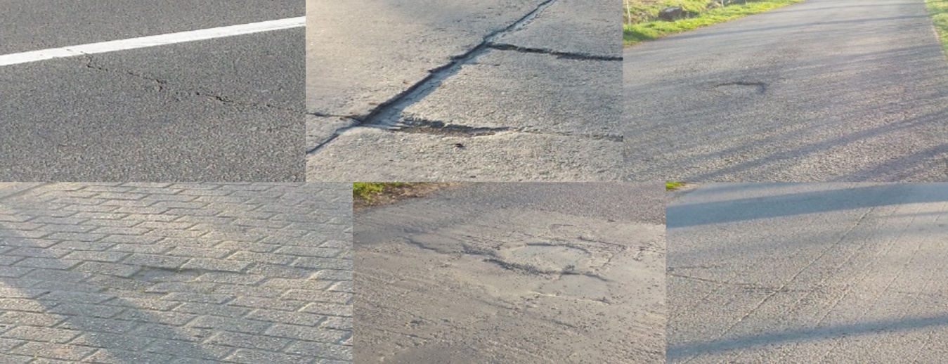
The technology developed by ASAsense within the project is now available as a service for road authorities, such as cities or local governments. The technology is broadly applicable and covers local roads that can have a wide variety of pavements (asphalt, concrete, cobblestones etc.). For more information, please visit PAVEsense.
In the longer run, ASAsense plans to further refine the system, by including an expert system that helps to interpret texture data and identify road defects such as potholes, alligator cracks, rutting, etc., and by including predictive models for the evolution of pavement state, allowing to deploy maintenance campaigns just in time.
Our partners for this project:








Publications:
More technical details about this solution can be found in the references below. Feel free to contact us for inquiries.
- J. David, W. Van Hauwermeiren, L. Dekoninck, T. De Pessemier, W. Joseph, K. Filipan, B. De Coensel, D. Botteldooren, L. Martens. Rolling-noise-relevant classification of pavement based on opportunistic sound and vibration monitoring in cars. In Proceedings of the 48th International Congress and Exhibition on Noise Control Engineering (Internoise), Madrid, Spain (2019).
- W. Van Hauwermeiren, J. David, L. Dekoninck, T. De Pessemier, W. Joseph, D. Botteldooren, L. Martens, K. Filipan, B. De Coensel. Assessing road pavement quality based on opportunistic in-car sound and vibration monitoring. In Proceedings of the 26th International Congress on Sound and Vibration (ICSV), Montreal, Canada (2019).
- L. Dekoninck, W. Van Hauwermeiren, J. David, K. Filipan, T. De Pessemier, B. De Coensel, W. Joseph, L. Martens, D. Botteldooren. Opportunistic in-vehicle noise measurements assess road surface quality to improve noise mapping: preliminary results from the MobiSense project. In Proceedings of the 23rd International Congress on Acoustics (ICA), Aachen, Germany (2019).
- B. De Coensel, K. Filipan, W. Van Hauwermeiren, J. David, L. Dekoninck, T. De Pessemier, W. Joseph, L. Martens, D. Botteldooren. Opportunistic sensing for road pavement monitoring. In Proceedings of the Transport Research Arena (TRA), Helsinki, Finland (2020).
- J. David, T. De Pessemier, L. Dekoninck, B. De Coensel, W. Joseph, D. Botteldooren, L. Martens. Detection of road pavement quality using statistical clustering methods. Journal of Intelligent Information Systems (2019).
Press coverage:
The MobiSense project received some press coverage, links can be found below (all in Dutch):
- De Standaard: https://www.standaard.be/cnt/dmf20191125_04737246
- Het Nieuwsblad: Burgers brengen staat wegdek in kaart
- imec: MobiSense project page and closing leaflet